ADVERTISEMENT
ADVERTISEMENT


NISAR’s first radar images reveal U.S. coastlines, farms, and forests
The spacecraft, launched on July 30 by the Indian Space Research Organisation (ISRO), carries two sophisticated radar systems—an L-band system provided by NASA and an S-band system built by ISRO.
-
 Lalit K Jha (IANS)
 - Thu, 25, Sep 2025
- 22:56 EDT
- 62
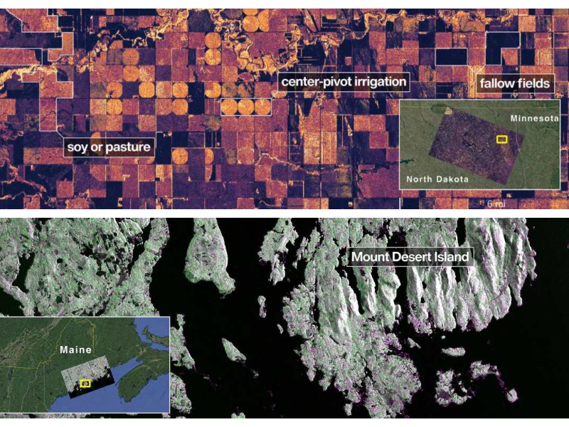 Images captured by the satellite, featuring the varied terrain of Minnesota and the Maine coastline / NISAR Satellite
NASA and ISRO on Sept. 25 released the first radar images from their joint NISAR satellite, offering a detailed look at Maine’s rugged coastlines and North Dakota’s patchwork farmland. The photos mark the beginning of a mission designed to transform how scientists and policymakers monitor Earth’s land and ice.
“Launched under President Trump in conjunction with India, NISAR’s first images are a testament to what can be achieved when we unite around a shared vision of innovation and discovery,” said acting NASA Administrator Sean Duffy. “This is only the beginning.”
ALSO READ: US, India launch powerful Earth-monitoring satellite
This post is for paying subscribers only
SUBSCRIBE NOWRelated


.jpg)


ADVERTISEMENT

ADVERTISEMENT
E Paper
Video

Comments
Start the conversation
Become a member of New India Abroad to start commenting.
Sign Up Now
Already have an account? Login